Hurricane Isaias made landfall near Destin, Florida, as a Category 2 storm with maximum sustained winds of 105 mph, prompting flood watches and flash flood emergencies across the Gulf Coast and the Southeast before weakening to a post-tropical cyclone. The storm is the latest reminder of how quickly a tropical disturbance can intensify into a life-threatening hurricane. But to make sense of what happened with Isaias — and what forecasters were watching on their hurricane trackers — it helps to understand the science behind it: how hurricanes form over warm ocean water, how meteorologists predict where a storm will go, and what a flood watch actually means.
Here's a closer look at the forces that turned Isaias into a powerful storm and the tools experts use to keep people safe.
How a Hurricane Like Isaias Forms Over Warm Ocean Water
Hurricanes are essentially giant heat engines that run on warm, moist air. According to NOAA, they form over the ocean, often beginning as a tropical wave — a low-pressure area that moves through the moisture-rich tropics and can trigger clusters of showers and thunderstorms.
For those thunderstorms to organize into a spinning storm, three ingredients have to come together, explains the UCAR Center for Science Education: warm ocean water, moisture, and light winds high in the atmosphere. NASA puts it simply — tropical cyclones use warm, moist air as fuel, which is why they only form over warm ocean waters near the equator.
The process works like this: the sun heats the ocean surface until the water reaches at least 79°F to 80°F. That warm water evaporates, sending water vapor rising into the sky. As the vapor cools, it condenses into clouds and releases heat, which warms the surrounding air and makes it rise even faster. That rising air leaves behind a pocket of low pressure at the surface, and air from the surrounding area rushes in to fill the gap. That incoming air heats up, rises, and the cycle repeats.
Because Earth rotates, this in-rushing air starts to spin — an effect known as the Coriolis effect — eventually forming the familiar rotating spiral with a calm eye at the center. As long as the storm stays over warm water, it keeps drawing energy and strengthening. Isaias took shape over the warm waters of the Gulf of Mexico, where conditions were ripe for rapid intensification.
From Tropical Disturbance to Category 2: The Stages of a Hurricane
Not every cluster of thunderstorms becomes a hurricane. Meteorologists classify tropical cyclones by their maximum sustained wind speed, and each storm climbs through a series of stages.
It starts as a tropical disturbance, then becomes a tropical depression once winds are organized but still below 39 mph. When sustained winds reach 39 mph, the system is upgraded to a tropical storm and given a name — in this case, Isaias. Once winds hit 74 mph, the storm officially becomes a hurricane, according to the National Weather Service.
From there, the Saffir-Simpson Hurricane Wind Scale ranks hurricanes from Category 1 to Category 5 based only on maximum sustained wind speed. Category 1 storms pack winds of 74 to 95 mph, Category 2 ranges from 96 to 110 mph, and Category 3 and higher — with winds of at least 111 mph — are classified as major hurricanes.
Isaias reached Category 3 strength offshore with winds near 110 mph before weakening slightly as it approached the coast. It ultimately made landfall as a strong Category 2 hurricane, with sustained winds of 105 mph. Notably, the Saffir-Simpson scale measures wind alone — it does not account for storm surge or rainfall, which are often a hurricane's deadliest threats.
Timeline: Isaias's Path From the Gulf to Landfall
The storm's final approach moved quickly once it neared the coast. Here's how the key moments unfolded:
- Gulf of Mexico: Isaias strengthened over warm Gulf waters, briefly reaching Category 3 intensity with winds near 110 mph.
- Friday evening: The National Hurricane Center issued warnings as Isaias approached the Florida Panhandle, with tropical storm-force winds beginning to lash the shoreline hours before landfall.
- Around 8:30 p.m. CT: Isaias made landfall near Destin, Florida, as a Category 2 hurricane with 105 mph sustained winds.
- Within about 30 minutes: The storm weakened to a post-tropical cyclone as it moved inland, but its heavy rain and gusty winds continued.
- Overnight and Saturday: Remnants pushed through Alabama and Georgia, with flood watches issued for metro Atlanta and much of north Georgia.
A flash flood emergency was declared in southern Okaloosa County, Florida, as torrential rain fell, and forecasters warned of a moderate risk (level 3 of 4) of excessive rainfall across the Florida Panhandle and into the Southeast.
Inside the Hurricane Tracker: Satellites, Hunter Planes, and the Forecast Cone
So how do forecasters know where a storm like Isaias is heading? Modern hurricane tracking relies on layers of technology that all feed into the National Hurricane Center (NHC).
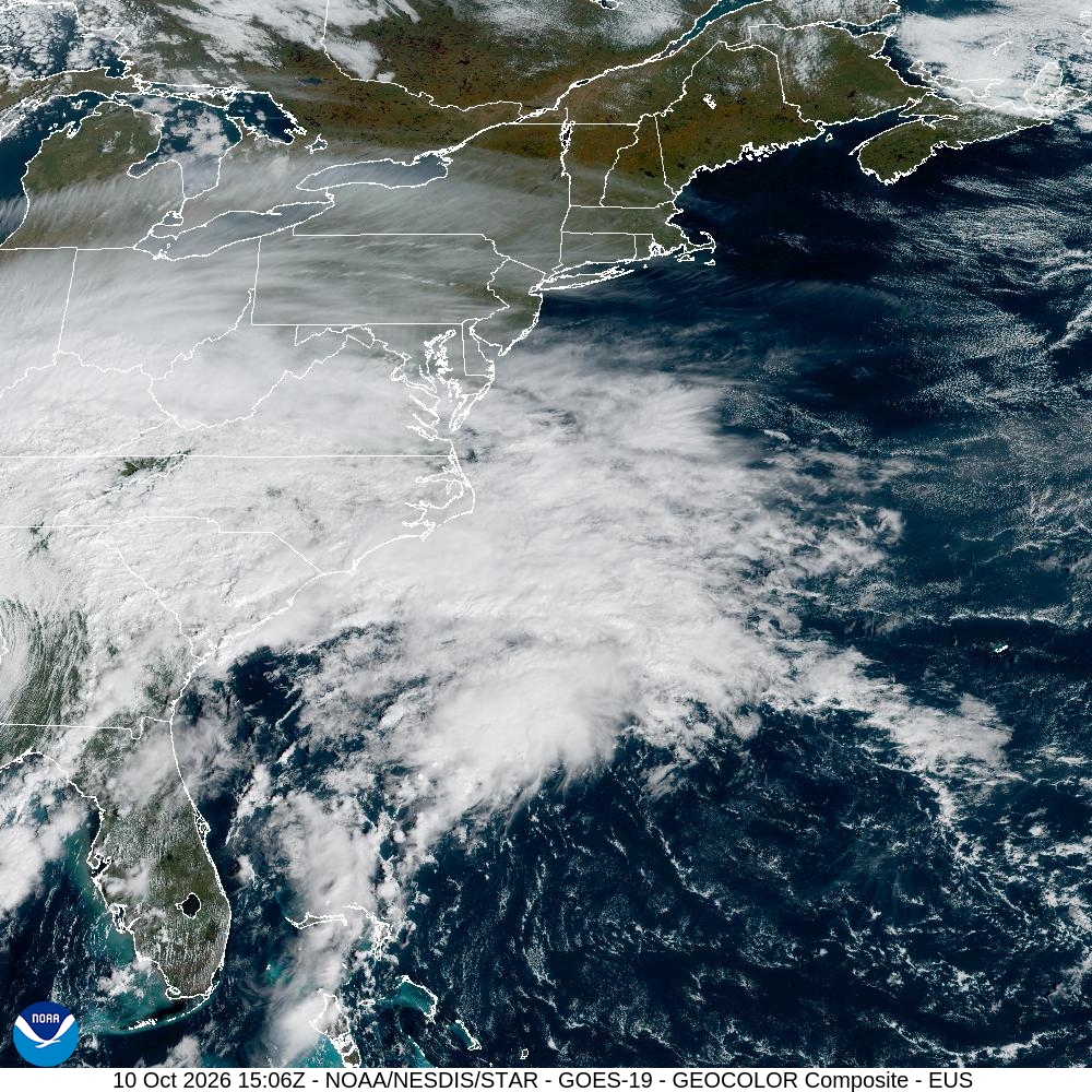
Satellites provide the big picture. NOAA's GOES and polar-orbiting satellites beam back near-real-time imagery of the storm's clouds, size, and motion, giving forecasters a continuous view from space. But satellites can only see the outside of the storm.
For a look inside, NOAA's "Hurricane Hunters" fly specially equipped aircraft directly into the eye of the hurricane. Scientists aboard drop instruments called dropsondes — small, parachute-equipped sensors — through the storm. Each dropsonde measures pressure, temperature, humidity, and wind speed and direction as it falls, transmitting a vertical profile of the storm's core back to the aircraft and, ultimately, to forecasters on the ground.
All of this data feeds into computer models that produce the familiar "forecast cone." Many people assume the cone shows the size of the storm or where damage will occur, but that's a common misconception. The NHC explains that the cone represents the probable track of the storm's center, built from the error in historical forecasts. The center of the storm stays within the cone about 60 to 70 percent of the time — roughly two out of every three forecasts — which is why forecasters stress that impacts can extend far outside the cone.
Why a Flood Watch Was Issued: Watch vs. Warning Explained
As Isaias approached, forecasters issued flood watches across parts of the Southeast. The terminology can be confusing, but the National Weather Service offers a simple way to remember the difference: a watch means "be prepared," while a warning means "take action."
A flood watch is issued when conditions are favorable for flooding — meaning flooding is possible but not yet certain. It's a signal to review your plans, monitor updates, and be ready to move to higher ground. A flood warning, by contrast, means flooding is imminent or already occurring, and you should act immediately to protect life and property. A flash flood warning is even more urgent, signaling rapidly developing, life-threatening flooding.
In Isaias's case, a flood watch was issued for metro Atlanta and most of north Georgia as the storm's remnants pushed inland, with some areas expecting 1 to 3 inches of rain and higher amounts locally. Meanwhile, a flash flood emergency in southern Okaloosa County, Florida, indicated that dangerous flooding was actively underway near the point of landfall.
What Happens Next: The Road Ahead for Isaias's Remnants
Even after Isaias lost its hurricane status, the danger wasn't over. Post-tropical cyclones still carry heavy rain and strong, gusty winds that can trigger inland flooding, tornadoes, and widespread power outages far from where the storm came ashore.
In the hours after landfall, the storm's remnants brought heavy rainfall and flooding threats to Georgia and Alabama, with the system expected to continue toward the mid-Atlantic and Northeast through the weekend. Winds from the storm were strong enough to rip the roof off a hotel in Florida, and power crews worked to restore electricity to affected areas. Forecasters urged residents along the inland path to keep monitoring alerts, because the flood threat often peaks well after the wind subsides.
The Bottom Line: Key Points to Remember
- Hurricanes form over warm ocean water (at least 79–80°F), beginning as a tropical wave and powered by rising warm, moist air.
- A cyclone progresses from tropical depression (below 39 mph) to tropical storm (39–73 mph) to hurricane (74 mph or higher).
- The Saffir-Simpson scale ranks hurricanes Category 1 through 5 based only on sustained wind speed; Isaias was a Category 2 at landfall.
- The NHC forecast cone shows the probable track of a storm's center, which stays within the cone about 60–70 percent of the time.
- A flood watch means "be prepared" (flooding is possible); a flood warning means "take action" (flooding is happening or imminent).