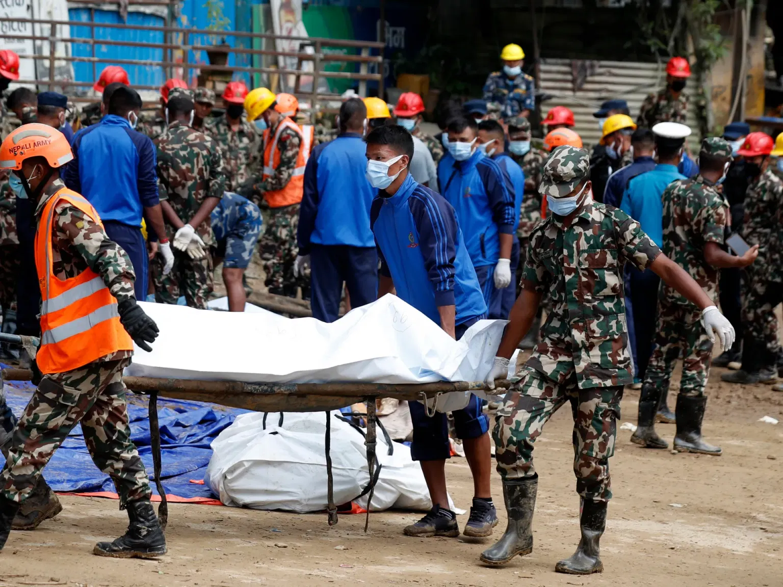
Nepal is a landlocked country in South Asia, tucked between China's Tibet region to the north and India along its other three sides. But in late September 2024, the world heard its name for a far more alarming reason: torrential monsoon rain unleashed flash floods and landslides that killed more than 200 people and left parts of the capital, Kathmandu, underwater in the heaviest rainfall the region had seen since at least 1970. To understand what happened — and why Nepal is so vulnerable — it helps to answer two questions at once: where exactly is Nepal, and how does a flash flood actually form?
Where Nepal Sits — and Why Its Landscape Invites Water
Nepal stretches roughly 880 kilometres along the Himalayan axis and between 150 and 250 kilometres across, covering about 147,516 square kilometres. It is completely landlocked, with no coastline at all. The country can be split into three geographic bands: the lowland Terai in the south (about 17 per cent of its area), the hilly midlands (about 68 per cent), and the snow-capped Himal region in the north (about 15 per cent). That last band contains Mount Everest, the world's highest peak at 8,848 metres, while Nepal's lowest point sits just 59 metres above sea level — a vertical drop that shapes how water moves.
That extreme drop matters. Nepal's elevation ranges from under 100 metres to more than 8,000 metres, creating everything from tropical lowlands to perpetual snow. The year splits into a wet monsoon season from June to September and a dry season from October to June. During the summer monsoon, moisture-laden air sweeps up from the Bay of Bengal and collides with the Himalayas, dumping heavy rain on the hills — rain that rushes fast and hard through steep valleys into major river systems such as the Koshi, Gandaki (Narayani), Karnali and Mahakali.
What Is a Flash Flood — and How Does It Form?
A flash flood is the rapid flooding of low-lying areas — riverbeds, washes, dry lakes and depressions — that occurs within six hours (often far less) of heavy rain. It can be triggered by intense thunderstorms, tropical storms, or rapid snow and ice melt, and it can also follow the collapse of a dam or a natural ice or debris dam.
What makes a flash flood so dangerous is its speed. Because the water arrives with little warning, people have almost no time to escape. Fast-moving water is far more powerful than it looks: as little as 60 centimetres (two feet) of moving water is enough to sweep away most SUVs, which is why safety campaigns repeat the phrase "Turn Around, Don't Drown." In the United States, floods kill more people in an average year — about 127 — than lightning, tornadoes, or hurricanes.
Timeline: How Nepal's 2024 Floods Unfolded
Nepal's monsoon season runs from June to September, and 2024 was unusually brutal from the start. In early July, at least 14 people died as flooding gripped South Asia. Then in mid-August, two glacial lakes burst near the village of Thame in the Everest region of Solukhumbu District, sweeping away homes and displacing 135 people — a reminder that in the high Himalaya, rising temperatures can melt glaciers and trigger so-called glacial lake outburst floods.
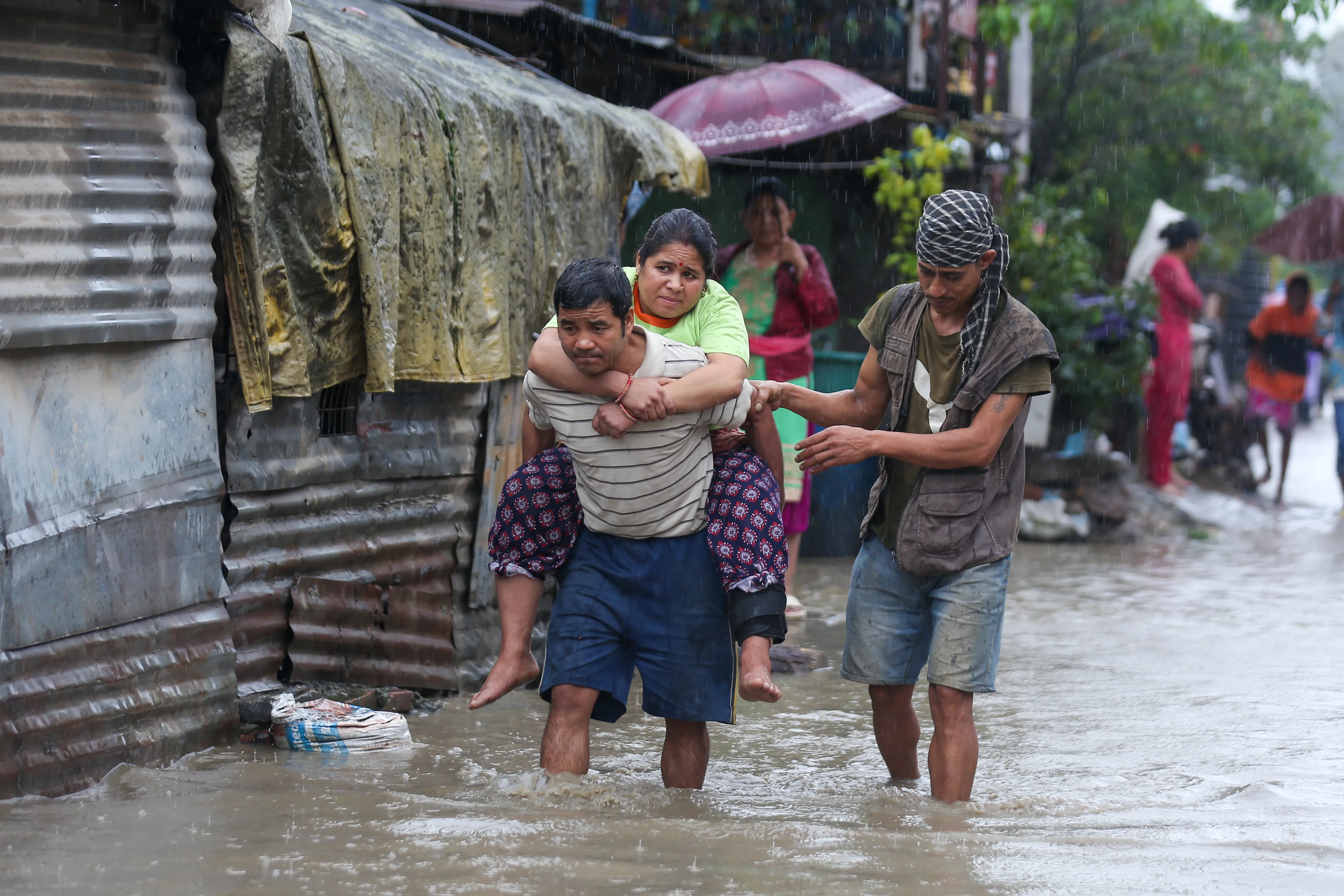
The worst came in late September. Beginning on 26 September, a low-pressure system lingering over northern India and the Bay of Bengal fed days of torrential rain across eastern and south-eastern Nepal. The Koshi River surged past its danger level, and the Bagmati and Nakkhu rivers swamped Bagmati Province. Between the mornings of 28 and 29 September, the Kathmandu Valley recorded between 240 and 322.2 millimetres of rain in 24 hours — the capital's heaviest rainfall since at least 1970.
Why Nepal's Flash Floods Turned So Deadly
Nepali weather official Binu Maharjan pointed to the low-pressure system as the immediate trigger, but experts say the disaster was amplified by human choices. Years of unplanned urbanisation have pushed construction onto floodplains, and drainage systems in Kathmandu simply could not handle the volume of water. Deforestation and hillside farming also loosen soil, turning heavy rain into landslides as well as floods.
There is also a longer-term factor: climate change. Warmer air holds more moisture, and agencies including the Red Cross Red Crescent Climate Centre have noted that extreme rainfall events are becoming more intense. Combined with Nepal's steep terrain and fast-flowing rivers, a storm that once would have been merely severe can now become catastrophic.
The Human Cost: What the Floods Left Behind
The toll was staggering. By early October, the government and international agencies reported at least 224 deaths, with dozens more missing and thousands rescued. In Kathmandu alone, the Bagmati River rose about two metres above its safe level, flooding the south of the city. At least 37 people died in the capital, with 56 deaths across the wider valley. Residents climbed to rooftops and upper floors, where helicopters and inflatable rafts pulled them to safety, while much of the city lost power, internet and clean water.
Beyond the city, the floods damaged at least 322 houses and 16 bridges, blocked or destroyed highways — including the Prithvi Highway, where bodies were recovered from buried vehicles — and knocked out hydropower stations and telecommunication links. UNICEF raised particular alarm over children, reporting that 35 children under 18 had died and at least 12 schools were destroyed, stripping young people of both safety and their classrooms.
What Happens Next: Nepal's Road to Recovery
The government deployed more than 30,000 police and military personnel for rescue and clean-up, closed schools for three days, and suspended flights as it assessed damage estimated in the billions of rupees. In the longer term, the floods have renewed calls to rethink where and how Nepal builds — enforcing floodplain zoning, improving drainage, and strengthening early-warning systems that give people precious minutes to move to higher ground.
Climate experts argue that adaptation is no longer optional. As monsoon patterns shift and extreme rainfall becomes more common, officials say Nepal must prepare for a future in which flash floods like those of September 2024 are less of a surprise and more of a predictable hazard to plan around.
Key Takeaways: What to Remember
- Nepal is a landlocked Himalayan nation between China and India, with terrain that drops from Mount Everest (8,848 m) to just 59 m above sea level.
- A flash flood is rapid flooding within six hours of heavy rain, often caused by intense storms, rapid snowmelt, or dam failures.
- Nepal's June-to-September monsoon, steep river valleys and construction on floodplains make it especially flood-prone.
- In late September 2024, a low-pressure system dumped record rainfall on Kathmandu, killing more than 200 people and displacing thousands.